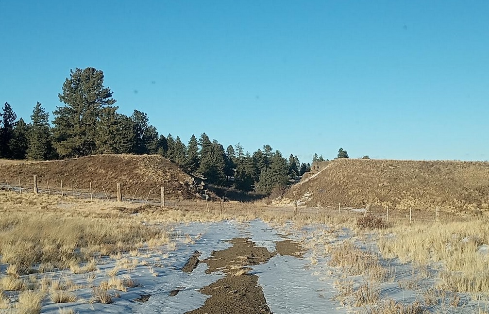
SOUTH PARK – RAILROADS AND THE GATEWAY TO THE ROCKY MOUNTAINS
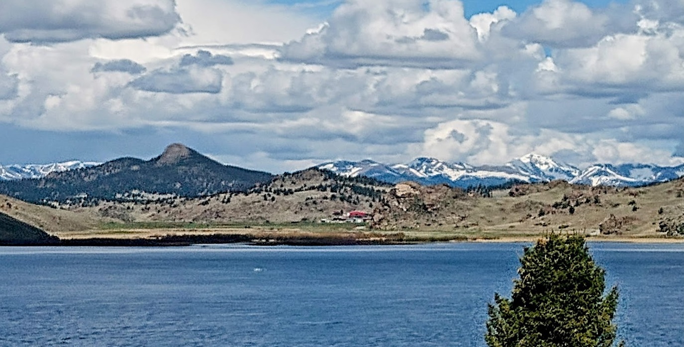
Located in the middle of Colorado, South Park figured prominently in the center of the “Pikes Peak or Bust” gold rush of 1859.

")
In the late 1800’s there where 2 Railroads in Southpark.
- The Colorado Midland and the Denver, South Park & Pacific.

The Colorado Midland Railroad came from Colorado Springs.
- Which came west up Ute Pass around the north side of Pikes Peak to South Park from 11 Mile Canyon, along the South Platte River.
The Denver, South Park & Pacific RR came over Kenosha Pass.
Both Railroads exited South Park and headwaters of the South Platte over Trout Creek Pass to Buena Vista.
- And then to the Arkansas River valley and the very Heart of the Rocky Mountains.

This Post will concentrate on the DSP&P Railroad and the South Park region.
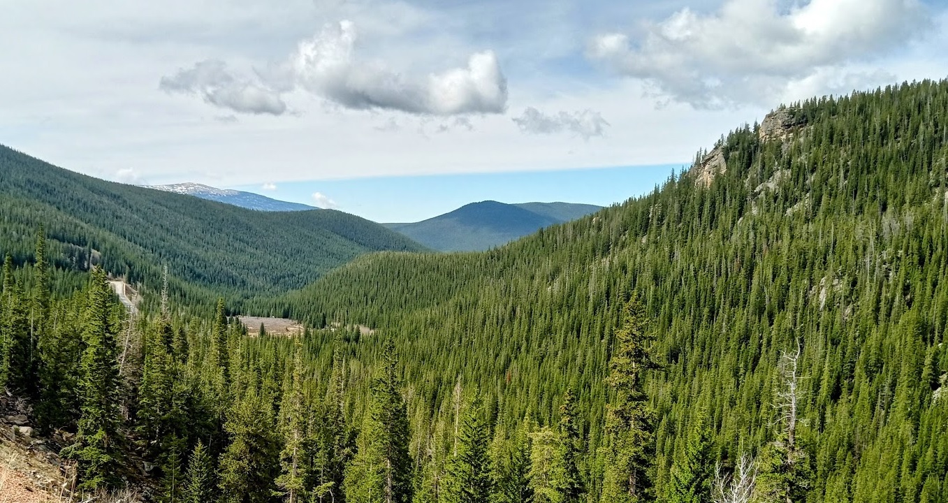
Mountainous chains and peaks in every variety of perspective, every hue of vista, fringe the view… the whole western world is, in a sense, but an expansion of these Mountains.
– Poet Walt Whitman, at Kenosha Pass, 1879
But the story of South Park and the Rocky Mountains began much earlier:
FORMATION OF THE ROCKIES
")
At one time, this part of North America, including South Park was near the equator and was a series of islands in a very large ocean.
- Around 250 to 300 million years ago, a ridge of mountains known as the Ancestral Rockies formed in roughly the same area as the current Rockies.
- Over time, glaciers eroded these 26,000 foot mountains into the deep valleys as the plates moved from tropical areas closer to the poles.
Later, new activity pushed up the current Rockies from 30 to 70 million years ago.
- Volcanic activity oozed mineral-bearing water and lava up through the rock layers to form the Colorado Mineral belt.
- The Mineral belt runs from the Four Corners northeast through Breckenridge and on through Golden and Boulder, just west of Denver.
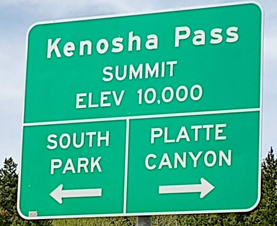
KENOSHA PASS – GATEWAY TO SOUTH PARK FROM DENVER AND THE NORTH
From the Kenosha Pass Summit, with the mountains parading across the horizon, early travelers must have envisioned their destinies stretching out before them.
- As if they had reached their threshold of opportunity.
- As an important route from the east into Colorado’s Rocky Mountains, Kenosha Pass has long served as a Gateway to good fortune.
- And its share of hard luck.
Through this portal the Native Americans had access to the abundant game herds of South Park.
- In the early nineteenth century, fur trappers came here in search of pelts.
- The gold strikes of the 1860s flung the door further wide open.
- Miners poured through by the thousands, bound for Fairplay and other diggings.
- The rough trail from Denver widened into a wagon road, and was then joined by the Railroad.
- Kenosha Pass became one of the Rocky Mountains’ main ports of entry.
- Funneling traffic to Leadville, Breckenridge, Aspen, and beyond.
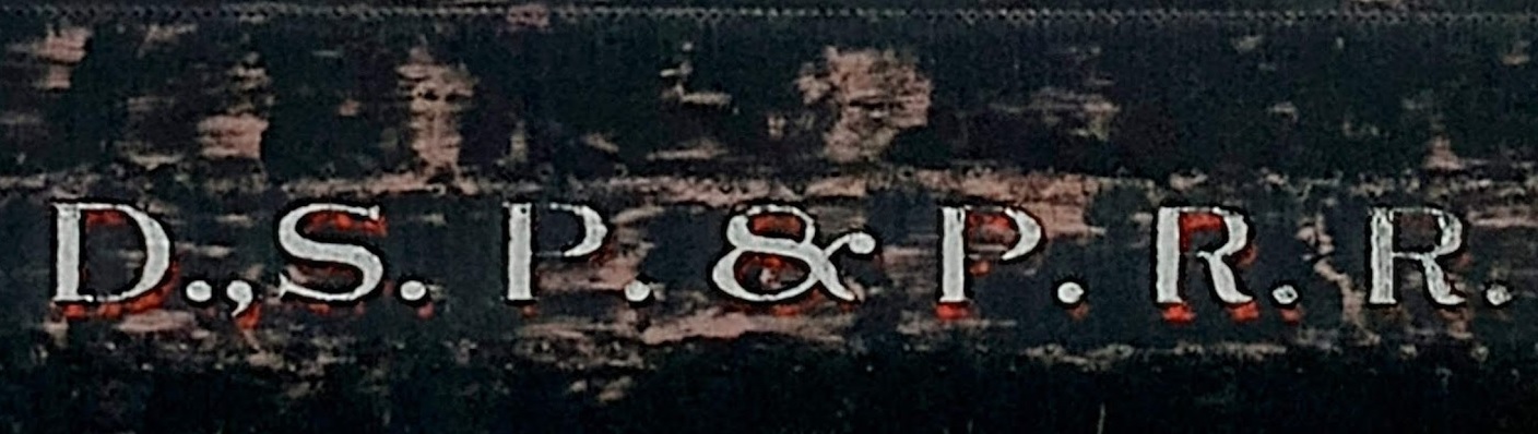
DENVER, SOUTH PARK & PACIFIC RAILROAD
Though the DSP&P Railroads’s tracks over Kenosha Pass and through the Alpine Tunnel were the world’s highest in Colorado for a time:
The Denver, South Park Pacific was fundamentally a second-place railroad.
- The rival Colorado Central Railroad beat the DSP&P to the gold fields of Central City and Black Hawk.
- While the Denver & Rio Grande Western Railroad won the race for silver-rich Leadville.
- But second place was good enough for the mining & ranching communities along the DSP&P.
- To them this narrow-gauge railroad was a mighty engine of economic growth.
- Their link to the smelters and stockyards of Denver.

")

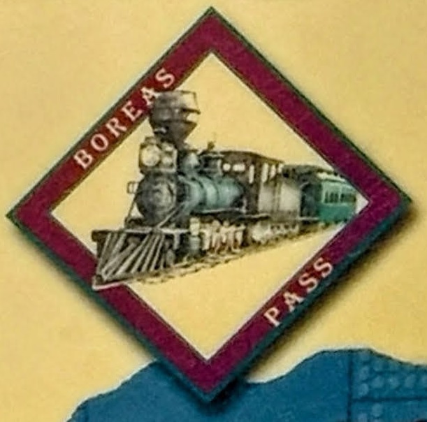
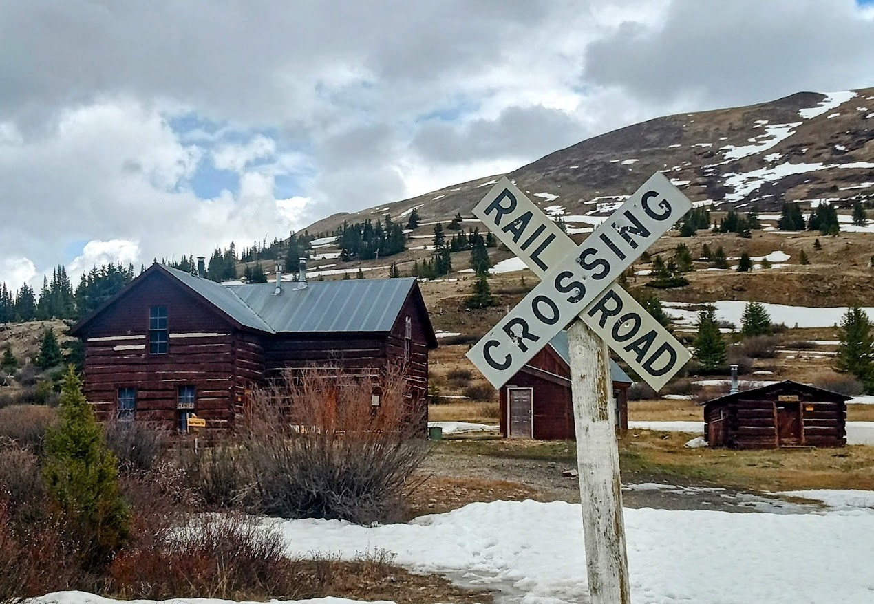
Boreas Pass and The Highline to Breckenridge
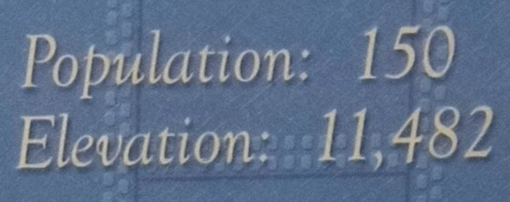
Despite the incredibly harsh domain at over 11,000 feet, at least 150 people lived at Boreas Pass.
- The Idea of the community centered around servicing the railroad.

The Highline had to follow a very circuitous route.
- Twenty-two miles of track connected Como and Breckenridge, which were only 14 miles apart.
- Sixty- three miles of track ran from Como to Leadville, only 22 miles away as the crow flies.

The Highline to Breckenridge and Leadville was built at a cost of $ 1.1 million dollars
- The 63 miles of track between Como and Leadville used about 5,500 tons of rail and 200,000 ties.
- Many of the ties were hewn from the ancient bristlecone pines in the area, significantly diminishing their numbers.
Tourism also emerged as a key underpinning of the DSP&P’s operations.
Despite building branches to Breckenridge, Leadville, and to Gunnison through the Alpine Tunnel: The DSP&P never quite overcame its runner-up status.
- Chronic financial problems, worsened by a series of brutal winters.
- Sent the Railroad into bankruptcy, and much of the line was abandoned by the 1920s.
SOUTH PARK MINING
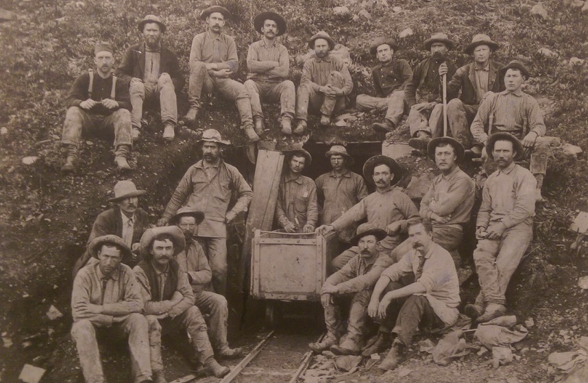
The 1859 Pikes Peak Gold Rush led to an explosion of settlers to Southpark.
- In 1860, Park County’s approximately 10,000 residents made up a third of the population of Colorado Territory.
- Initially, gold was found in stream beds or on the ground and along the creek banks
- Where it had settled after being carried downhill from the erosion of uphill parent deposits.
- “Placer” mining was the earliest form of mining in South Park near Fairplay.
- Use of basic methods such as panning, sluicing soon evolved into more invasive methods.
- Hydraulic mining and dredging, to reach more mineral deposits.
- Around 1865, the concentration of gold in placer deposits dwindled
- So the miners turned to the more expensive method of hard rock mining.
- On site Mills, would helped reduce costs by milling the ore on-site.
- Or to nearby at places for shipping the ore to market.
- Eventually, smelters developed near Alma, which would become the refining center for South Park ore.
SOUTH PARK RANCHING
Ranching started in South Park in 1860.
- Some intrepid entrepreneurs discovered that they could make more by feeding miners than by doing the mining.

Due to the high altitude and prolonged cold that makes the growing season exceptionally short in the South Park region…
- Cattle ranching is the dominant agricultural product in the South Park area.
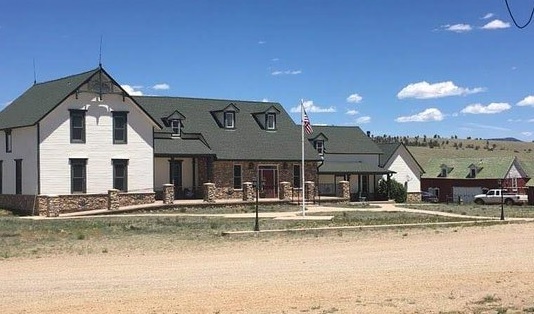
- Prominent ranchers included Sam Hartsel, the original homesteader of the Hartsel Springs Ranch.
- And the Hall family, which homesteaded and has owned the Salt Works Ranch since 1862.

- Even after the arrival of the railroad, South Park still experienced fall cattle drives.
- Many ranchers preferred to send their livestock to market rather than to try to provide for them during long and blustery winters.

The prime period for homesteading in South Park ran from the first arrival of ranchers in 1861 until around 1925.
- As some of the first established year-round residents, ranchers found themselves responding to the needs of travelers.
- Hosting people on a ranch became a frequent activity early on in South Park.
Boreas Pass and The Highline to Breckenridge
![]()
- The town of Boreas Pass centered around servicing the railroad.
- Some of the buildings constructed during that time still remain.
The Highline followed a very circuitous route.
- Sixty-three miles of track ran from Como to Leadville.
- The 63 miles of track between Como and Leadville used about 5,500 tons of rail and 200,000 ties.
- Many of the ties were hewn from the ancient bristlecone pines in the area, significantly diminishing their numbers.
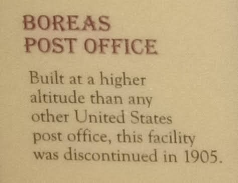
BOREAS POST OFFICE – The Highest POST OFFICE EVER

- Built at a higher altitude than any other United States post office, this facility was discontinued in 1905.
THE COMO DEPOT
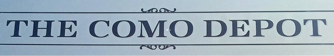

In June 1879, the Denver South Park & Pacific Railroad built the Como depot just in time to greet the first train into town.
- For the next two years, all trains stopped at the depot as they traveled between Denver and Gunnison.
- The Alpine Tunnel to Gunnison was the Railroad Highest Tunnel ever constructed in the Rocky Mountains
- In 1881, Como became a major division point as the railroad began building the “High line” over Boreas Pass to Breckenridge.
- And eventually to Leadville.
- Como was a bustling town with hundreds of people employed by the railroad.
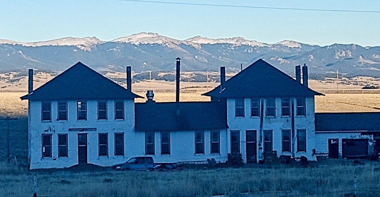
For 58 years, from 1879 to 1937, the Train Depot served both the town and the railroad well.
- Things began to slow down in 1910 with the closing of Alpine Tunnel, Trout Creek Pass, and Boreas Pass (temporarily).
ALPINE TUNNEL HISTORIC DISTRICT
- These closures greatly reduced the railroad’s total trackage.
- In the early 1900s, mining activity diminished and improved automobiles and roads continued to intrude into the railroad’s business.

The railroad hung on until 1937.
- When the last passenger train from Leadville to Denver left town on April 10th.
- The following year, the rails were taken up.
- As the last scrap-train left town on September 2nd, 1938, it was truly the end of an era.
- Through all those years, the daily arrival of the train was the highlight of each day.
- The Railroad brought people from far-away places, supplies, and “dreams” from the Sears & Roebuck catalog.
- During the long and harsh South Park winters, the railroad provided the only viable means for contact with the outside world.
- Enabling people to come and go and to bring in vital food and supplies.

For the next seven decades, the depot served various owners as a garage and storage shed, receiving no maintenance whatsoever.
- In 2008, when restoration efforts first began, the depot was virtually ready to collapse.
- Over the next six years, many partners came together and completed the restoration in 2014.

Today the Como Museum contains many artifacts from the railroad era in Como.
- To convey the story of Como, the railroad and the hardy people who were a part of it.
Wilkerson Pass and South Park, where you’ll find one of the Highest Peaks in North America.

To the west extend sweeping views of three mountain ranges and the South Platte River headwaters
- And a glimpse back into the colorful days of mining, railroads, and ranching.
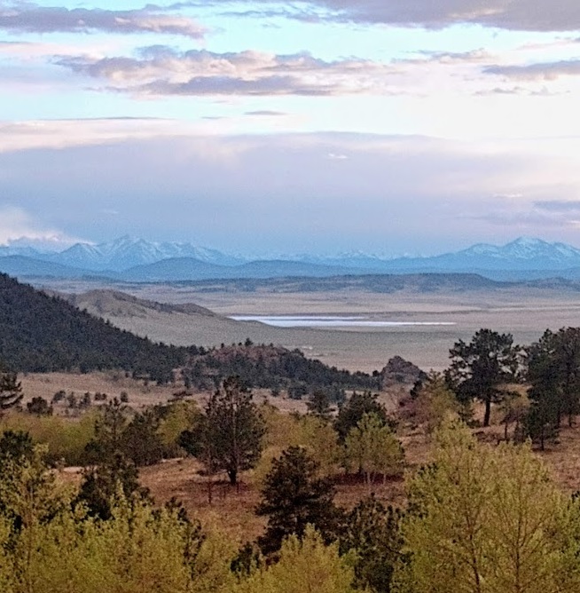

To the east stands the World Famous Pikes Peak, and the Florissant Fossil Beds National Monument.


Within this landscape, you can fish in Gold Medal Waters.
- Camp or Lodge & reflect on vast open spaces, and explore the past.

South Park is a special place for both visitors and residents, alike.
GREAT DIVIDE RIDES
Adventure Rides on the Continental Divide
Trout Creek Pass INFO
Colorado Mountain Pass INFO in the Heart of the Rockies

Ride all of these passes at the Hartsel Adventure Rendezvous in early October

Como, Boreas Pass, Breck, Loveland Pass, Silverplume, Guanella Pass
- Google Photo Share LINK