
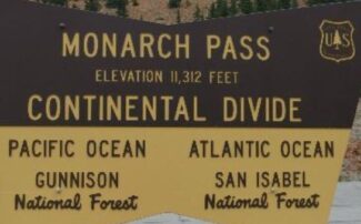
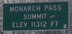
Monarch Pass is the highest point on the Coast to Coast US Hwy 50 at an elevation of 11,312′ .

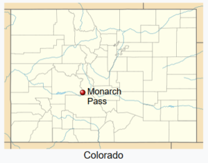
The Pass is located on the Continental Divide at the southern end of the Sawatch Range, approximately 25 miles west of the town of Salida.

The Pass carries U.S. Hwy 50 over the Sawatch Range and the Divide.
- Providing a route on the west side between Tomichi Creek and the summit, in the upper basin of the Gunnison River which flows into the Colorado River.
- On the east side the road follows the South Arkansas River, a tributary of the Arkansas River, to the top of the Continental Divide.
- A 7% grades exists in places, and the area is prone to heavy winter snowfall, often resulting in temporary closures during severe winter storms.
- Ramps for runaway trucks are located about halfway down both sides of Monarch Pass.
Scenery
The pass is widely considered one of the most scenic in Colorado, offering a panoramic view of the southern end of the Sawatch Range from the summit. During the winter, visitors can enjoy skiing at Monarch ski area.
Old Monarch Pass
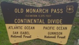
An unpaved road over Old Monarch Pass, elevation 11,365 feet connects to U.S. 50 on both sides of the Divide.
- Old Monarch Pass starts after you pass the Monarch Ski Resort, just before you reach the top of the paved Monarch Pass.
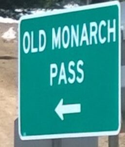
Old Monarch Pass road can be accessed from HWY 50 on the east side of the summit of Monarch Pass, or from the White Pine Road, on the west side.
- Old Monarch Pass at an elevation of 11,375′ was actually the second Monarch Pass.
- It opened in 1921, and was engineered for ‘Automobiles’.
- The original pass was a toll-road which opened in 1880.
- It was traveled by wagon or stagecoach, and crosses what is now the Monarch Ski Area.
- Today the first Pass is referred to as “Old Old Monarch Pass”.
- Present-day Monarch Pass at an elevation of 11,312′ was opened in 1939.
- Each new pass was re-routed to reduce sharp curves, increase safety, and shorten the distance.

The first two Monarch Passes were closed in winter, which isolated Gunnison.
- By the late 1930’s, there was a need to have a pass which was open year-round.
- In order to reduce the numerous hairpin curves of Old Monarch Pass and build the road in the sunniest locations, one or two local historic cemeteries were destroyed.
- Also, the state highway engineer at the time, Charles Vail, renamed the pass “Vail Pass” after himself.
- Local residents were outraged, and tore down all the new “Vail Pass” signs.
- The governor finally stepped in and reinstated the name “Monarch Pass”.
- The Old, Old Monarch Pass toll road was a stagecoach road which started as the mining boom exploded in the upper South Arkansas valley in the late 1870’s.
- The road provided access to White Pine and the Tomichi mining areas as well as to the Gunnison country.
- It was opened in 1880, and in 1881 it became a toll stagecoach road operated by the famous Barlow and Sanderson stage line.
Railroad up Monarch Pass

The D&RGW did not go over Monarch Pass, but up to a Limestone mine on Monarch Pass.
- It had been converted to Standard Gauge and ran until 1985.
- The old Monarch Branch of the D&RGW to the Monarch mine between Maysville and Garfield is a fun, little known ride.
Old Old Monarch Pass
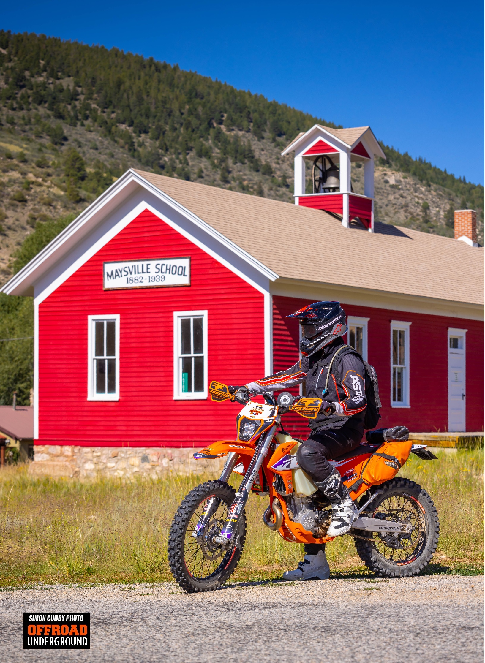
- The old old road ran up the South Arkansas valley through Maysville, Arbourville, Garfield, Monarch and Monarch Park.
- From the upper end of Monarch Park, the road took a series of steep, sharp switchbacks and climbed up from the valley floor.
- Through what became the Monarch Mountain Ski area before crossing the Continental Divide at the low point on the Great Divide ski run, at an elevation of 11,523′.
- The current ski area maintenance road from the north end of the ski area parking lot follows the old, old road to the Divide.
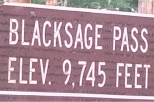
There was a toll gate at Maysville on the east side and one at Black Sage Pass on the west side.
- The road was only open in the summer months, as the winter snow made the route impassable.
- Apparently, the owners of the toll road did not keep good care of the road and charged what was thought to be high rates.
- In 1887 the county purchased the road for $1,400 and took over the maintenance.

Old Monarch Pass
In 1919, work began on a new, shorter, less steep and dangerous route which is known today as “Old Monarch Pass”, elevation 11,375′.
- This new ‘old’ route was opened to automobiles in 1921, and the older route was largely abandoned.
- The new route merged with the old, old road on the west side of the pass at the top of all the sharp hairpin curves, about 5 miles above the Whitepine Road, and from there the hairpin curves crisscross the old, old road.
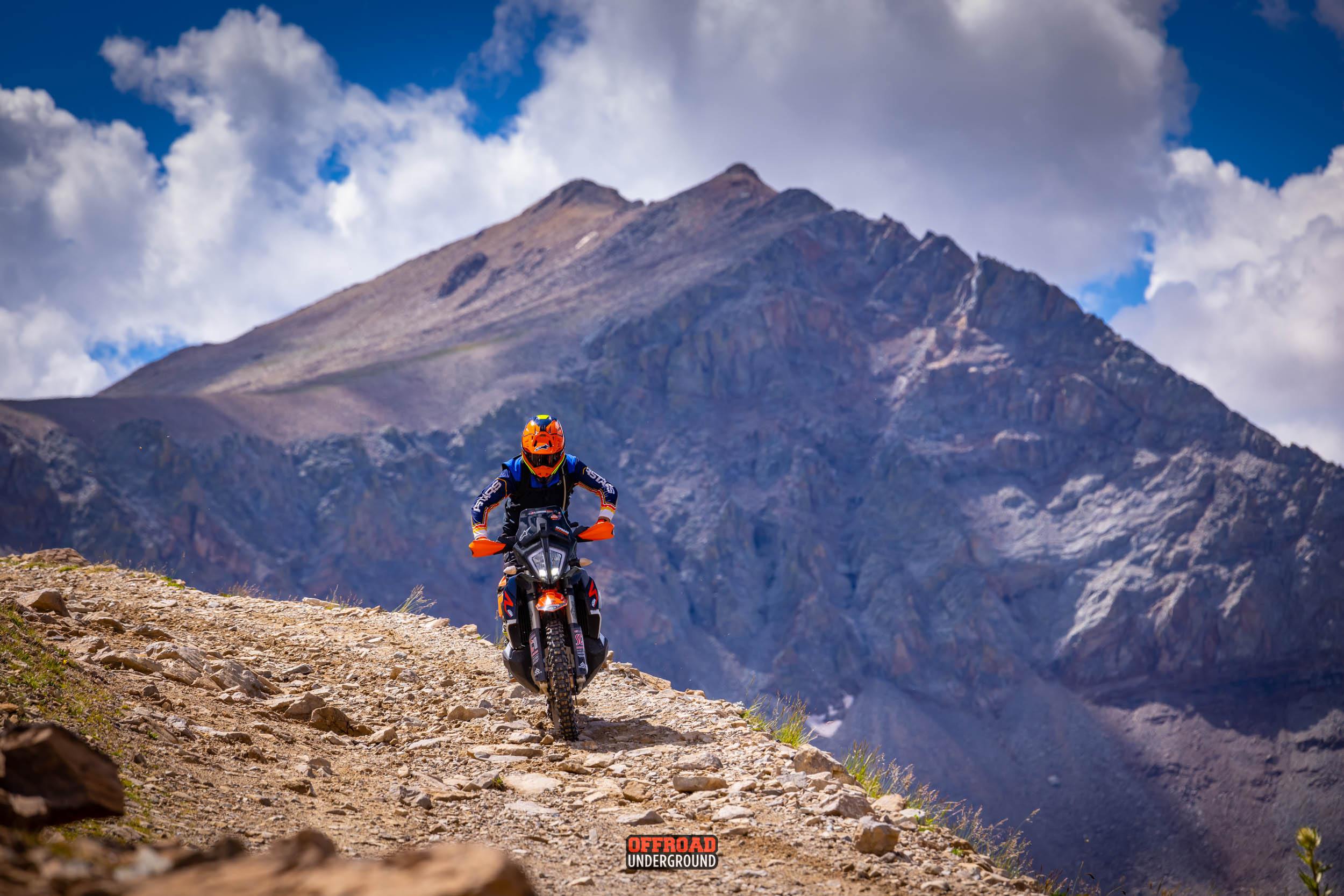
SINGLETRACK from the Summit
The old, old road is now a dirt bike and mountain bike trail, at least in the lower stretches.

The Continental Divide Trail (CDT) is Open to Motorcycles from near the summit of Old Monarch Pass to Marshall Pass.
![]()
![]()
- You can ride east from Old Monarch Pass over to Monarch Pass on the singletrack Continental Divide Trail, the distance is about a mile.
- And to Lujan and Cochetopa Pass 32 miles further south.

- The CDT is Singletrack to Marshall Pass, a distance of around 12 miles.
- From Marshall Pass you can tie into the Rainbow trail and make anywhere from 45 to 120 mile Singletrack loops.

Ride Monarch Pass at X Roads BV, the ADV Ride on the Divide and the Great Sand Dunes Loop.