
Independence Pass Info & Aspen History
Independence Pass is one of Colorado’s top 10 Scenic By-ways

Independence Pass is the 3rd highest Paved pass in the country.
The Pass starts on Hwy 24 between Buena Vista and Leadville at Twin Lakes, and ends in Aspen, Colorado.
- The “Top of the Rockies Byway,” has been designated by the U.S. Secretary of Transportation as a National Scenic Byway and one of America’s 10 best By-ways.
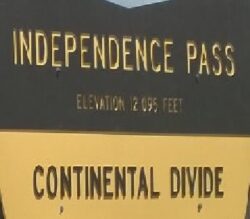
- The summit of Independence Pass at the Continental Divide is 12,095 feet above sea level.
- Independence Pass is an outstanding ride in the Autumn, and on the Hartsel Lodge Adventure Rendezvous in early October.

The Pass is a 32-mile drive from the Arkansas River to Aspen.
It is the 3rd highest paved road in the Country.
- The ride takes anywhere from an hour or 2 . Longer if you stop along the way to enjoy scenic views.
- The road is steep, narrow and twisty with only a few guardrails and has several one lane sections on the West side.

Ferdinand Hayden first surveyed the pass in 1873 in what was at the time Ute Indian Territory.
- Roadway improvements undertaken by B. Clark Wheeler in 1881 established the Pass to the Roaring For Valley as a toll road charging 25-cents for saddle horses and 50-cents for two-horse wagons.

Independence Pass was carved out of the land by glaciers and the erosive action of the Roaring Fork River over millions of years.
The Pass is the site of the first road in the Roaring Fork Valley, which was pioneered over Hunter Pass, the original name of Independence Pass, in 1881.
- The old stage road still remains visible from several locations on the West side.
- Traffic over Independence Pass fell off following the repeal of the Sherman Silver Purchase Act in 1893 that resulted in a crash of silver prices.
- That devastated the mining communities throughout the valley.
- The towns of Aspen, Ashcroft, Independence and Ruby all saw their population drop overnight as miners relocated to richer claims.
- As a result, roadway improvements over the Pass did not occur until 1927, and the road was not paved until 1967.

The ghost town of Independence sits three miles west of the summit.
It was inhabited by some 2,000 citizens who came to work mining claims in the area between 1880 and 1883.
- When the silver boom went bust, most people moved on to pursue other claims or moved to the lower altitude of Aspen.
- The final resident of Independence was Mr. J.R. Williams.
- Mr. Williams was one of the original miners and maintained a stamp mill in Independence until 1920.
- Surveyors named the Williams Mountains after Mr. Williams.
East of the Independence Pass

Highway 82 across Independence Pass is best driven from east to west, since this direction which offers the nicest views.
From the east, the journey begins just below the old Chaffee County seat of Granite, at the junction with US 24 in the upper Arkansas River valley, already at quite a high elevation of 9,100 feet.
- The first few miles parallel the north shores of Twin Lakes Reservoirs .
- Two scenic, interconnected lakes at the mouth of a narrow valley framed by several dramatic peaks beyond, attractively reflected in the calm waters.
- The lakes are popular for fishing, boating and picnicking.
- The highway rounds the marshy west end of the furthest lake and meets the inlet stream, which it follows for the next 12 miles.
- Through a quiet valley, bordered by smooth-sided, wooded mountain slopes.

To the right heading up the Pass, the hills rise up to Colorado’s highest peak, Mount Elbert.
At 14,439′ Mount Elbert is the highest summit of the Rocky Mountains in North America.
- Mt. Elbert is the highest point in the U.S. state of Colorado and the entire Mississippi River drainage basin.
- On the opposite side is La Plata Peak, at 14,360′ the fifth tallest mountain in the state, and several other summits in view also top 13,000 feet.
- The highway then passes two creekside campsites in a forested part of the canyon.
- Then moves into more open land and bends to the north, while still climbing only gradually.

Soon the road begins a much steeper ascent as it bends back south, traversing an exposed slope at the head of the valley.
Several long switchbacks take the road 1,300 feet higher over the next 4 miles to Independence Pass Summit.
- The Summit sits on the windswept Continental Divide and at the crest of the Sawatch Range.
- The boundary of the White River and San Isabel National Forests.
The Summit of Independence Pass
The land around the summit is flattish, windswept, lonely, and covered by sparse vegetation of grass and delicate tundra plants.
- Treeline is a thousand feet lower down – yet all around are higher mountains, especially to the south and east.
- Several shallow pools line the road around the pass, and patches of snow are likely to remain for most of the summer.
West of the Summit

West of Independence Pass, Hwy 82 descends at an 6% grade across steep, barren slopes of rock and bare earth.
- Through an area prone to landslides, and soon reaches the very upper end of Roaring Fork River.
- Which is then followed through thick woodland for 20 miles, all the way to the ski resort town of Aspen.
- En route are various trailheads, campsites and riverside parking areas plus one ghost town.
- -Independence, that was home to around 2,000 miners during a brief boom period in the late 1800s.
- Relics include cabins on the valley floor and the wooden frame of Farwell Stamp Mill, right beside the road.
- This section of the highway is generally narrower (a one-lane road in a few places) and a bit more bendy than east of the pass.
- Partly because of the trees, the views are more restricted, starting a little ways west of Independence.
About the Independence Ghost Town:
- Located just below the Continental Divide, the ghost town is on Independence Pass on the Top of the Rockies Scenic Byway.
- The first mining site in the Roaring Fork Valley, today, Independence is an archaeological preserve.
- Featuring interpretive stations that tell of the characters, enterprises, and structures that make it an integral part of area history.
A bit about Aspen History and a Timeline

When the silver mines around Aspen eventually petered out, this picturesque Victorian mountain town reinvented itself as a world-class ski resort.
Aspen set the trend that followed across the American West and dozens of ski areas were created on government forest service land.
- Catering to the rise in popularity of the sport of snow skiing.
- Today, Aspen is arguably the most glamorous of America’s ski resort towns.
- Being as popular with movie stars as it is with hardcore powder hounds.
The Silver Boom
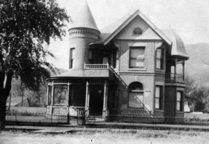
In 1893, Aspen was a thriving Victorian mining town in the middle of the Rocky Mountains.
- It had two theaters, an opera house, a hospital and several banks.
- Many of these original Victorian-era buildings and homes still stand, giving the town its charming atmosphere.
The Silver Bust
In 1893, when US President Cleveland repealed the Sherman Silver Purchase Act, the impetus disappeared for digging so much silver out of the mountains.
- Within weeks of the repeal, dozens of Aspen mines closed and thousands of miners found themselves out of luck, abandoning the town in droves.
A Vision of Snow and Skiing
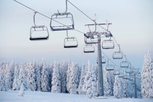
In 1930, only 700 people lived in this once-thriving mining town.
However, the lovely old buildings were still intact and the town continued to see heavy snow each winter.
- Friedl Pfeifer, a member of the 10th Mountain Division who had trained in the area during WWII, returned after the war and teamed up with Walter Paepcke to establish the Aspen Skiing Corporation in 1946.
- The rest is Aspen history, as they say.
- The town quickly grew into a hot spot for skiing and other alpine recreation.
- The restored Hotel Jerome reopened in 1947, along with the refurbished Wheeler Opera House – two local landmarks that are still in operation today.
- Aspen hosted the FIS World Championships in 1950, an event that put it on the global skiing map.
![]()
Culture to Match the Recreation
This has been a visionary town from the start.
- During the 1960s, the skiing history of Aspen expanded with the opening of Buttermilk and the Highlands (1958), followed by Snowmass in 1967.
- Aspen remains one of the world’s leading centers for alpine research, skiing and unique cultural events.
- Its primary source of income is tourism, but it’s a bustling four-season town and one of the most expensive places to live in America.
- Celebrities like author Hunter Thompson and singer-songwriter John Denver once called Aspen home, and most visitors wish they could do the same.

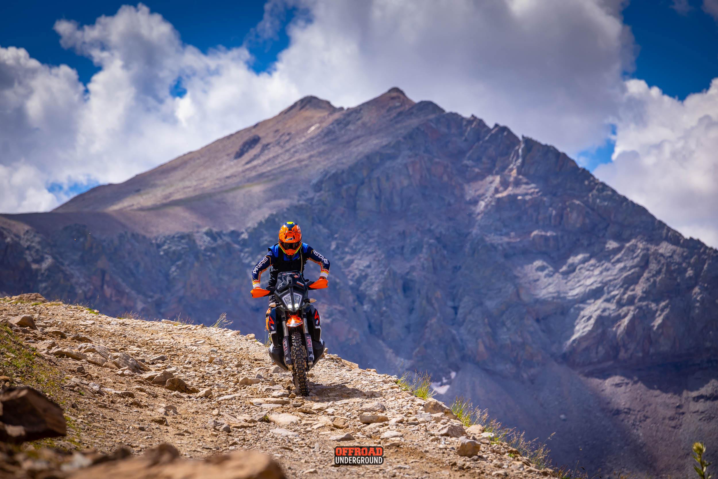
Independence Pass is an E-Ticket Adventure Ride
Hagerman Pass and Independence Pass make for an Outstanding Adventure Ride Loop.