
X-ROADS TRAILRIDE September 16-18 2022
X-ROADS TRAILRIDE 2 October 7-9 2022
Two epic trailrides on the same routes.
If you can’t make one date, maybe you can make the other ?
- X-Roads Trailride from Howard on Day 1 from the Arkansas River to the Rainbow trail.
- Then ride the Continental Divide Trail to a remote Campground over the Divide.
- Day 2 from the Campground back on the Continental Divide trail over the Divide to Howard, around Salida.
- Day 3 over a Mountain Pass from the Arkansas river watershed to the Rio Grande watershed.
- Then into an old mining area and back on the Silvercreek section of the Rainbow trail.
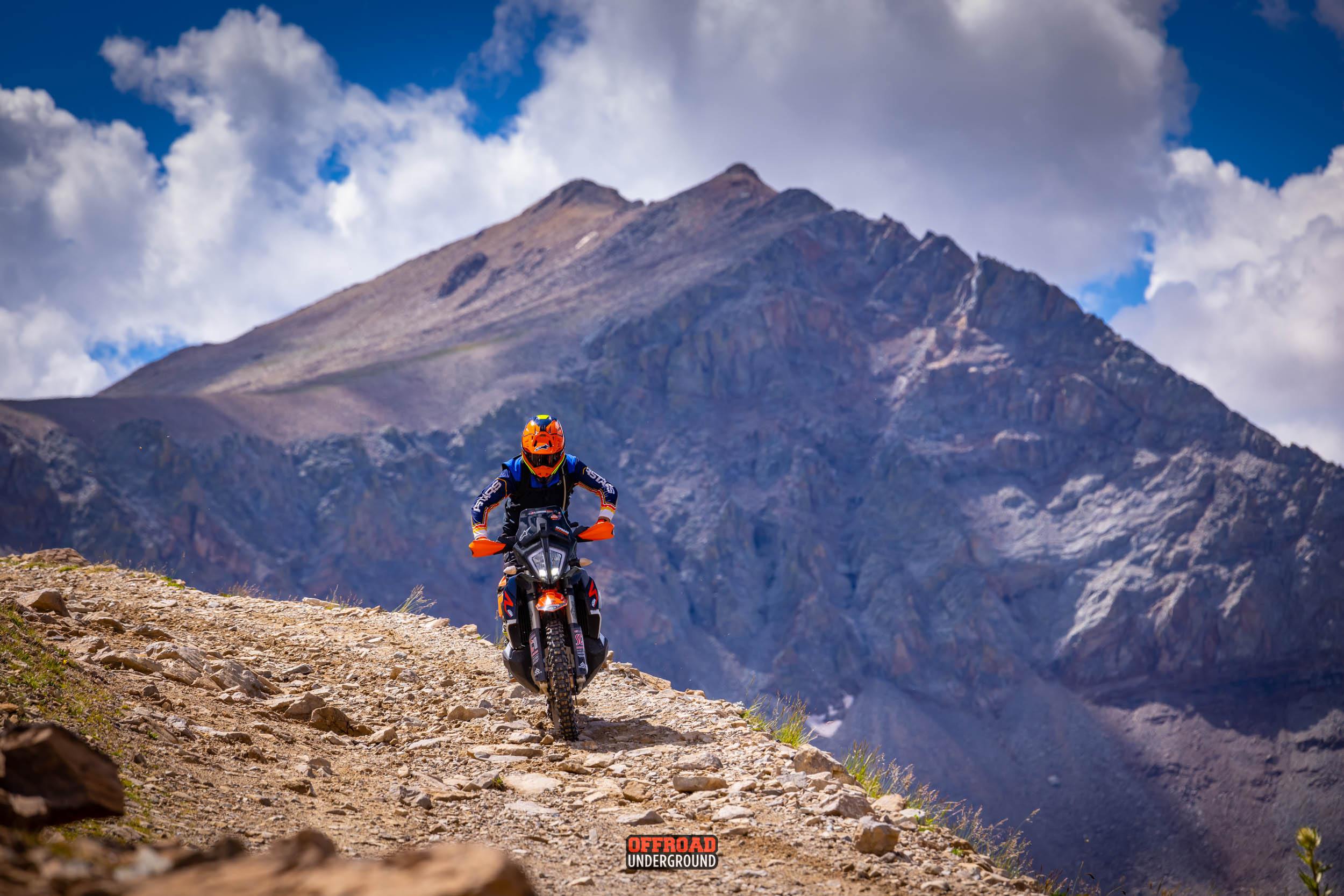
- Singletrack and little used 2 Track trailride for 3 days in the Heart of the Rocky Mountains.

Day 1
- East to West – 95 Miles
- 40 miles of Rainbow singletrack trail to Hwy 285.
- Cross Hwy to the Continental Divide Trail.
- Up a challenging creek trail to Marshall pass at 10,800 feet
- Ride at Treeline
- 70+ Miles of singletrack. Less than 10% pavement.
- Camp at destination Friday night.

Day 2
- Clockwise – 100 miles
- From the campground to over 11k+ foot Old Monarch summit.
- Ride at treeline on different trails than Day 1
- Continental Divide Trail singletrack to singletrack down to Hwy 50.
- To fuel in Poncha Springs.
- Ride below Mt. Shavano to cross Hwy 285.
- River Road to Smeltertown to Ute Mine trail.
- To Spiral Mtn to railroad 2 Track to Cleora.
- A few miles on Hwy 50 to Wellsville.
- Powerline/ River loop to campground on the river. 40+ miles singletrack.
- 2 track, & dirt roads. 10% pavement.
- Fuel & snacks available in town.

Day 3
- Clockwise – 96 Miles
- From the campground on the river.
- Ride downstream.
- To Hayden creek road. To over 10k+ foot Hayden pass.
- Fenceline trail below Sangre De Cristo’s to Alder creek.
- Clover creek to Otto Mears Tollroad.
- To Silvercreek / west Rainbow trailhead.
- Rainbow singletrack to Hwy 285.
- Cross 285 to east Rainbow singletrack.
- To Bearcreek. To Wellsville. To River road.
- To Campground.
- 30+ miles of singletrack.
- Spectacular challenging 2 track.
- Less than 5 miles of pavement.
- This is a remote loop with no fuel or snacks available.

Sign Up X Roads Trailride
X-ROADS TRAILRIDE September 16-18 2022
Sign Up X Roads Trailride 2
X-ROADS TRAILRIDE 2 October 7-9 2022